Everyone in Florida, by necessity, are amateur meteorologist (a meteorologist, also known as an atmospheric scientist). This is not because we are want-to-be geeks, studying weather models. The reality is that by now most of us have experienced extreme weather. Awareness and preparation is essential. My family calls as weather systems develop, knowing I study maps and models well ahead of formal watches and warnings.
 |
Hurricane Jeanne - Category 3 121 MPH Winds
23.75 in of rain in three days
|
The Hurricane season of 2004, between August 13 and September 25, brought four back-to-back hurricanes — the worst in Florida’s history. Hurricanes Charley, Frances, Ivan and Jeanne cause more than $45 billion in damages and dump 30 inches of rainfall. Jeanne sat stationary over Palm Beach County for over 24 hours with hurricane force winds on its south side and flooding rain. I experience being in the eye of the storm for over an hour. Temporary calmness and a blue sky above surrender by walls of fierce black, swirling clouds; surreal.
The very next year (2005) brought the most intense tropical cyclone in the Atlantic basin and the second-most intense tropical cyclone in the Western Hemisphere; Wilma. This one crossed Palm Beach County from the westt as a Category 2. An observation site located in Lake Okeechobee, observed a 1-minute average of 104 mph. (Wikipedia). This one storm did more damage in Palm Beach County than the previous year's four. Power was off for seven days. Overall, Wilma left about $19 billion in damage and 30 deaths in Florida, 5 from direct causes.
To not be aware of the potential danger and inadequately prepare could be deadly.
I have noticed that there is something very wrong with NOAA's weather model, "The GDS". There have been several named storms and depression already this season with the GFS barely acknowledging their development and movement.
Google AI has picked up on this: The Global Forecast System (GFS) is facing challenges including a decline in accuracy, especially in long-range forecasts (beyond 5 days), and a tendency to exhibit bias in predicting certain weather phenomena like light rain and warm, dry conditions in specific regions.
Below are two conflicting maps. The National Hurricane Center (HNC) is seeing potential development seven days out (20%). Although no development is expected, the GFS, seven days out, shows nothing. Not any storm development occurring or residual low pressure. Untypically quiet for late July. One Facebook post stated what has happened very specifically:
Get NOAA back up to full staff. That we needed more sensors, not less! This isn’t cutting in the name of waste, fraud, or inefficiency, this is just irresponsible cutting that will put people’s safety in jeopardy! [Already has in Texas.]
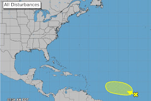 |
Nation Hurricane Center 7/19 Map
|
 |
| GFS Map looking forward seven day from 7/19 |
Is climate change denial overshadowing science and reality?


“Armature” meteorologists? Is that like a rotating radiologist? Methinks your spelling checker has delusions of AI. — Juliet
ReplyDeleteThanks Julie for the correction. However, the post is not about me.
Delete